[December 2021]
Route: KCCR - KBIH - KFLG - L41 - KFLG - KSEZ - L71 - KCCR

With Catherine, who supported my taking up flying and is now paying the price, we loaded up N21348 and set off for Flagstaff, AZ, for a long weekend visit to the Grand Canyon and vicinity. This was by far my longest trip yet and tested the limits of my endurance and our bladders. Our plan was to fly to Flagstaff on Thursday, drive to the Grand Canyon on Friday for a day hike, fly over the GC to Marble Canyon airstrip on Saturday, then head home with a stop for brunch in Sedona on Sunday. Lots of spectacular scenery, a few days in the hip outdoorsy college town of Flagstaff and a lot of flying time. We had perfect weather, and I didn’t mind that there was no opportunity to use my shiny new instrument rating.
I had originally planned the outbound leg around the south end of the Sierras through the Trona Gap (a 4 mile wide corridor between two restricted airspaces), in order to avoid too much high altitude mountain flying and the associated turbulence, rollers and need for O2. (There was no way to avoid a lot of mountainous terrain on this trip, but none of it requires altitudes over 11.5K if you don’t go over the Sierras.) However, as the trip got closer and I started watching the weather forecasts, it looked like the winds would be extremely benign over the summit, and I switched to the shorter and much more scenic route over Yosemite and the Tioga Pass. I arranged with Mike C. to get the club’s oxygen bottle (which apparently hasn’t seen use for a long time and whose accompanying plastic tubing has decayed to near unusability), got it filled at PSA and figured out how to jerry rig a connection to my cannula. (I had one for my wife but she chose not to use it.) I’ve hiked at over 14K in the last decade so I wasn’t too worried about my ability to function, but also didn’t want to take needless risks. The first stage of my planned route was over Hetch Hetchy (and the Grand Canyon of the Tuolumne, so making this trip a Grand Canyon twofer), Tuolumne Meadows, navigating the Tioga Pass at 12.5K, then descending to Bishop for refueling and a picnic lunch.
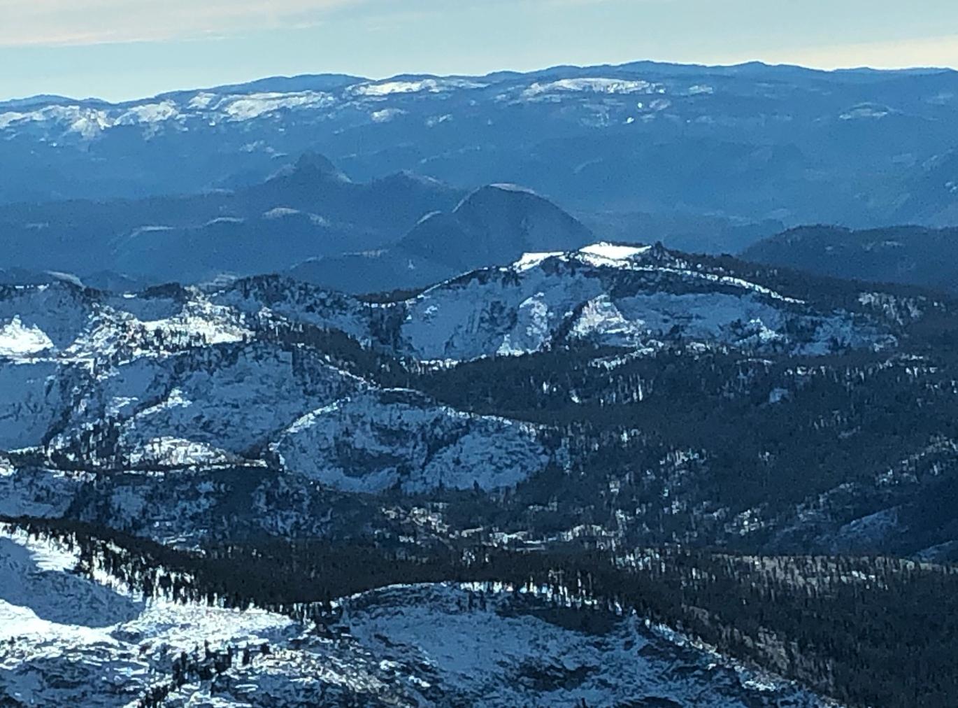
The departure day was forecast clear but with tule fog sticking around until fairly late. In the event the field was VFR by 9am. With delays for picking up the oxygen and figuring out how to hook it up, we took off around 10:30 and climbed to 11.5K eastbound across the central valley. I started watching my oxygen level and as it hit the low 80s I turned on the supply, which quickly took me up to 99. (I can’t say I felt any different.) The route was pretty direct until reaching Tuolumne Meadows. Approaching the high country we climbed another 1000’ which gave plenty of clearance, though there are nearby ridges and peaks at over 13K. Going over Tuolumne Meadows we watched a faster plane zoom past 1000’ below, dodging and weaving to avoid terrain. We lost sight of him and he might have gone through Buckeye Pass to the north. The first photo below shows the view towards Half Dome and Mt. Starr King from over Tuolumne Meadows. Somewhere around here Oakland Center lost us on radar & cut us loose.
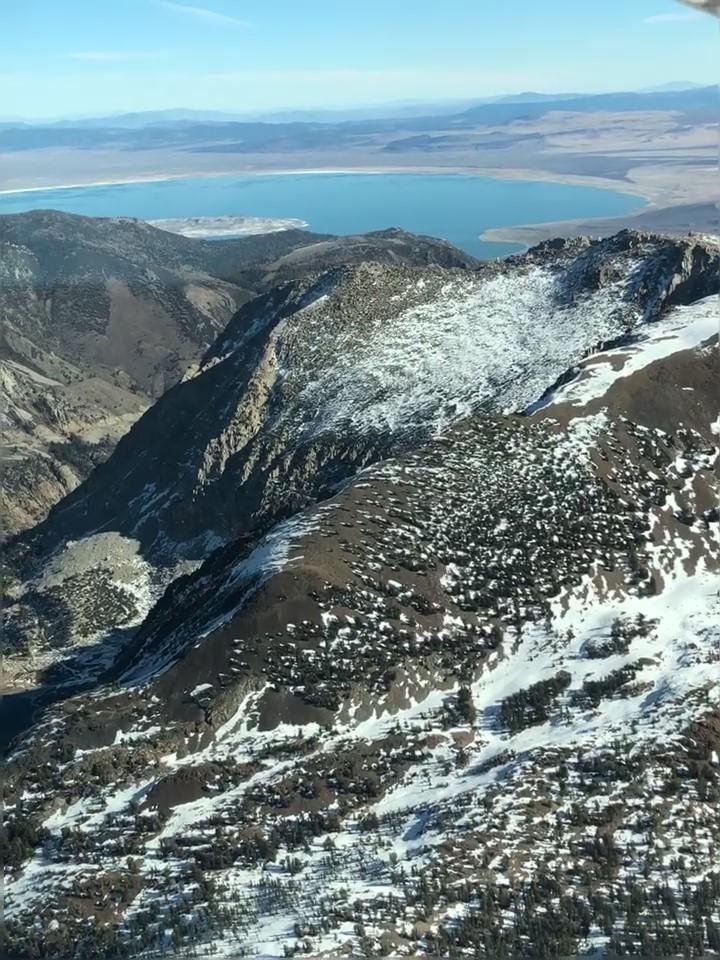
After Tuolumne Meadows, we made a couple of sharp turns to get through the Tioga Pass. (I had programmed those into the GTN with VOR/radial/distance user waypoints.) The photo below shows the east side of the Tioga Pass from the passenger seat, with Mono Lake in the distance. You can just make out the road on the north side of the canyon. Just after this spot we turned right to drop down that canyon.
The flight down the east side of the mountains, past Mammoth Lakes to Bishop was uneventful. There was a light breeze from the north, so I took us around to land on 30. We sat by the FBO and ate our picnic lunch. (There’s a Thai restaurant on the field but it was closed.) I then had my first go at self-fueling, and after a couple of miscues got the plane topped up for the next, longer leg.
The next segment took us south of the restricted areas, over the northern end of Death Valley, and eastward towards Vegas. We took off from Bishop paralleling the mountains on the east flank of the Owens Valley, gaining enough altitude to turn southeast, then crossing the MOAs. The desert looked pretty harsh & forbidding, but at least there was no shortage of flat-looking areas for emergency outs.
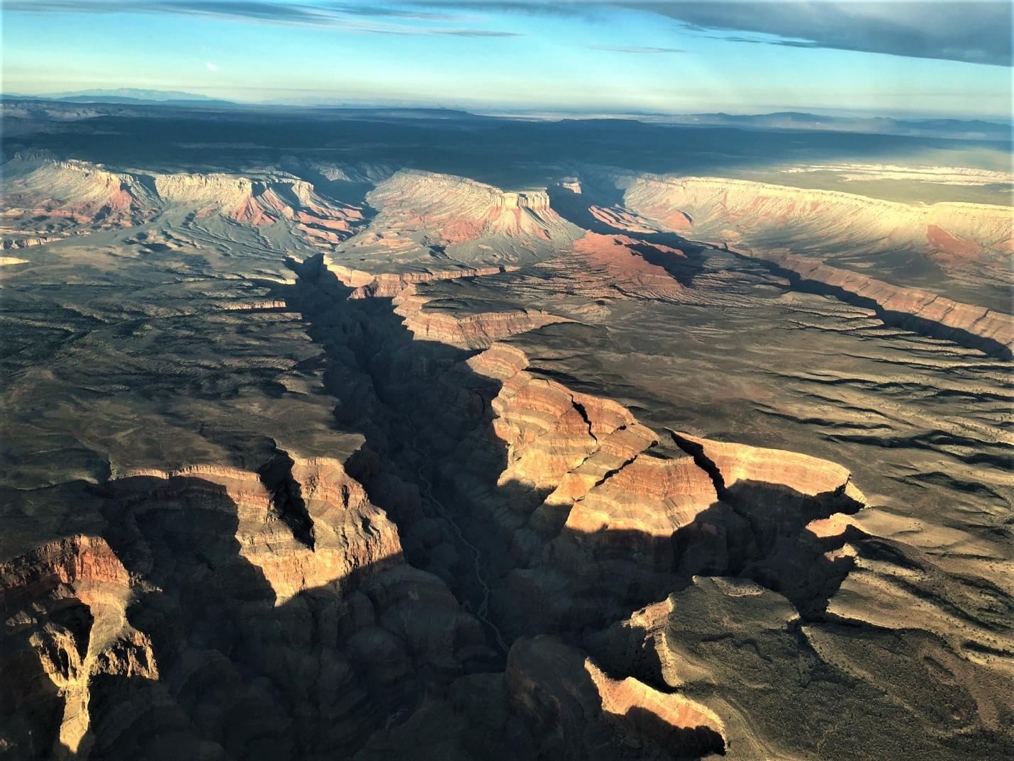
I had trouble getting flight following in the area. I was able to reach Joshua Control, but they said they had no radar coverage at my altitude (9.5K). Eventually I got in touch with LA Center about 50nm west of LAS. Soon after, approach asked my intentions and gave me a Bravo transition unasked. We flew directly over KLAS and headed for the Hoover Dam. Unfortunately that took us right into the arrivals, and approach turned us to the south and kept us high, so we weren’t able to get a closeup look at the dam, though it still looked pretty impressive from altitude. We continued northeast along the edge of Lake Mead, then turned southeast to cross the western end of the Grand Canyon. The sun was already low so we got spectacular colors on the canyon walls. You can just make out the Colorado at the bottom of the inner canyon here.
The sun went down before we made KFLG, and I had a little reminder of the difficulty of finding an unfamiliar field in the dark. Between the airport’s beacon and the moving map with the pink line for visual approach, though, it wasn’t a real problem. KFLG is a class D field and as far as I could tell it was the same controller on the radio for both tower and ground on all four interactions we had. He was, uh, not a micromanager. (He didn’t want me to bother him on the ground frequency once I got off the runway, and three days later he didn’t really care how I left the area.)
We parked at the FBO (Wiseman Aviation) where the fuel is expensive but the linemen are helpful and friendly. The kid on duty helped us with our luggage, then took us on his cart on the roundabout route over to the main terminal where we’d arranged a car rental.
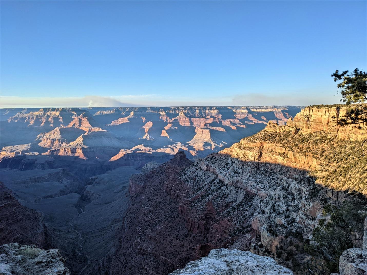
The next day was on the ground: we drove up to the Canyon & hiked down the South Kaibab trail, a bit less than half way to the river (about 2200’ vertical). That got us just below ONeill’s butte, the fin sticking up on the lower part of the ridge in the picture below. It’s a spectacular hike, easily doable in a few hours down & back on a mild day. Just to give an idea, the first marked stop on the trail is called “Ooh Aah Point”. I think the experience of seeing the Canyon can be summarized by saying that it’s mind boggling even if you expect your mind to be boggled.
After the hike back up, we strolled along the rim until sunset watching the light and colors change, then got on the road for the 90 minute drive back to Flagstaff. Just before we got to the town, Catherine had been looking out at the now pitch dark sky and exclaimed first “that’s weird” then “whoa, what’s that?” then “stop the car”. I pulled over, got out & looked up to see a line of SpaceX Starlink satellites crossing the sky. They looked something like this: https://www.youtube.com/watch?v=MzAVq9amZSI&t=0s. It was very surreal - impossible to tell how high or how fast they were moving, but they were pretty unmistakable and very bright. No wonder the professional astronomers working with the billion dollar telescopes & looking at faint ancient light are upset…
Day 3 we got an early start – up at 6:30, quick breakfast, then off to the airport. I wanted to fly up to Marble Canyon (L41), a paved strip down below the rim of the Canyon, and Catherine wanted time later in the day to visit some terrestrial attractions in town. We got to the airport by 8ish, only to find the plane covered in frost. Having just finished my instrument training, I was duly concerned about the effects of even a bit of frost on the wings & control surfaces, so we spent a half hour with paper towels and ladder cleaning off the wings & tail. About the time the sun was finally warming the surfaces above freezing, we got in & tried to get going. No dice. The engine wouldn’t start. After about 10 tries where the engine would turn over a few times & seem to catch before quitting, we finally got help from a lineman who brought over a preheater, which worked sort of like a little jet engine blowing hot diesel exhaust at the air intakes. After fifteen minutes it started right up. So, an hour or so later than planned, we headed off to cross the Canyon & then land in it.
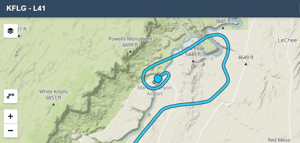
The GC has its own FARs, mainly for commercial tour operators, but also for GA, on where you can fly and at what altitude. The sectional shows north/south “corridors” where you can cross, with self-announce on entry & exit. We took the Dragon corridor north at 11.5K, then dropping to 9.5K as we continued up the Marble Canyon Sector. L41 is up at the northern end of the National Park area at 3600’ elevation, well below the Canyon rim at around 7K. The flight rules in the area allow planes to descend below 3K AGL “within 3 miles of the airport”. That’s not a lot of room for a normal descent. Instead, I got more or less over the field then did a wide spiraling descent. Here’s the track log. That jog at the start was to try to catch a good view of the famous Horseshoe Bend oxbow just to the north. Turns out I was off by one oxbow & the one I was looking for is further to the north.
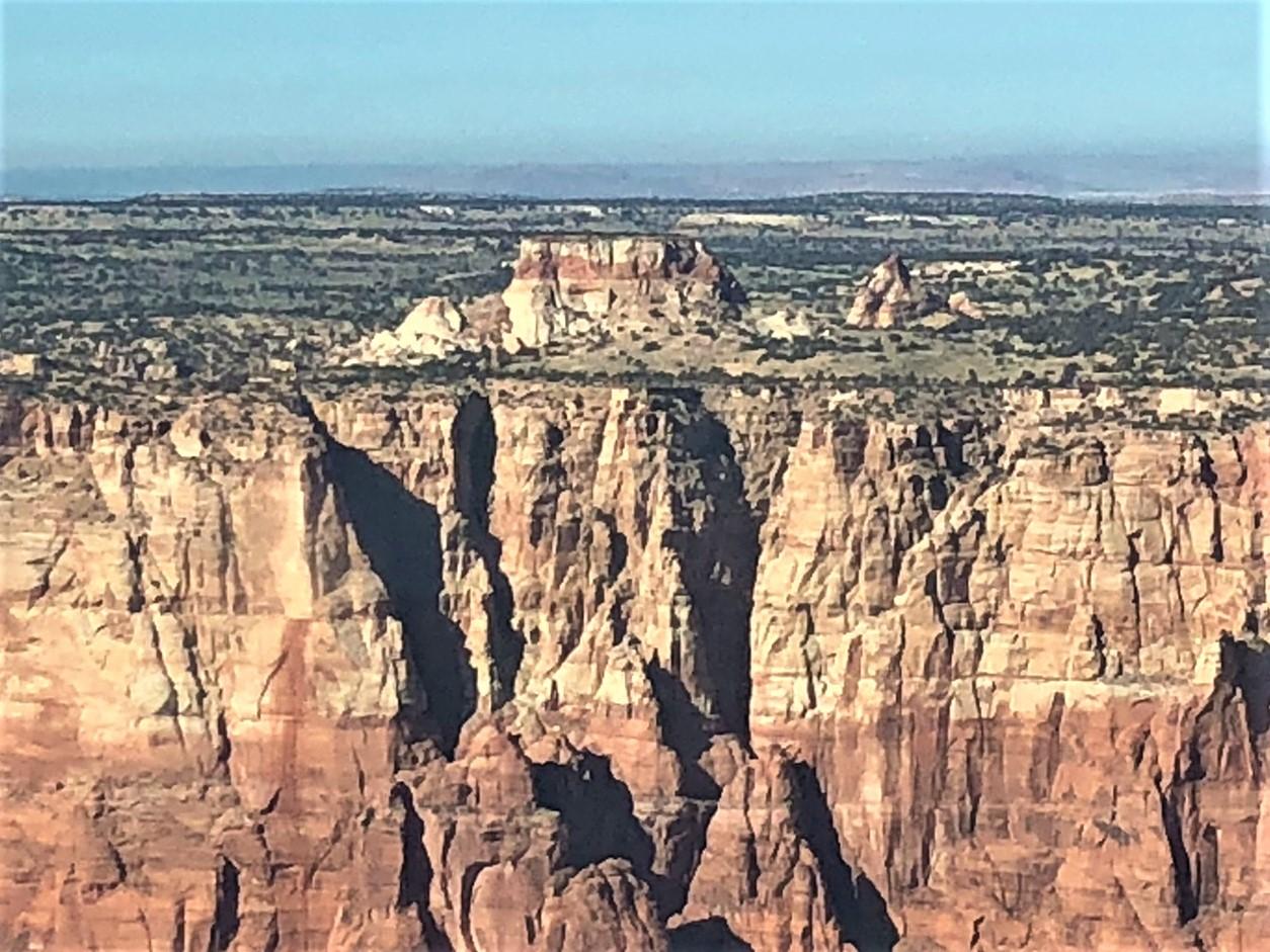
This was the view from the right window as we descended below the rim.
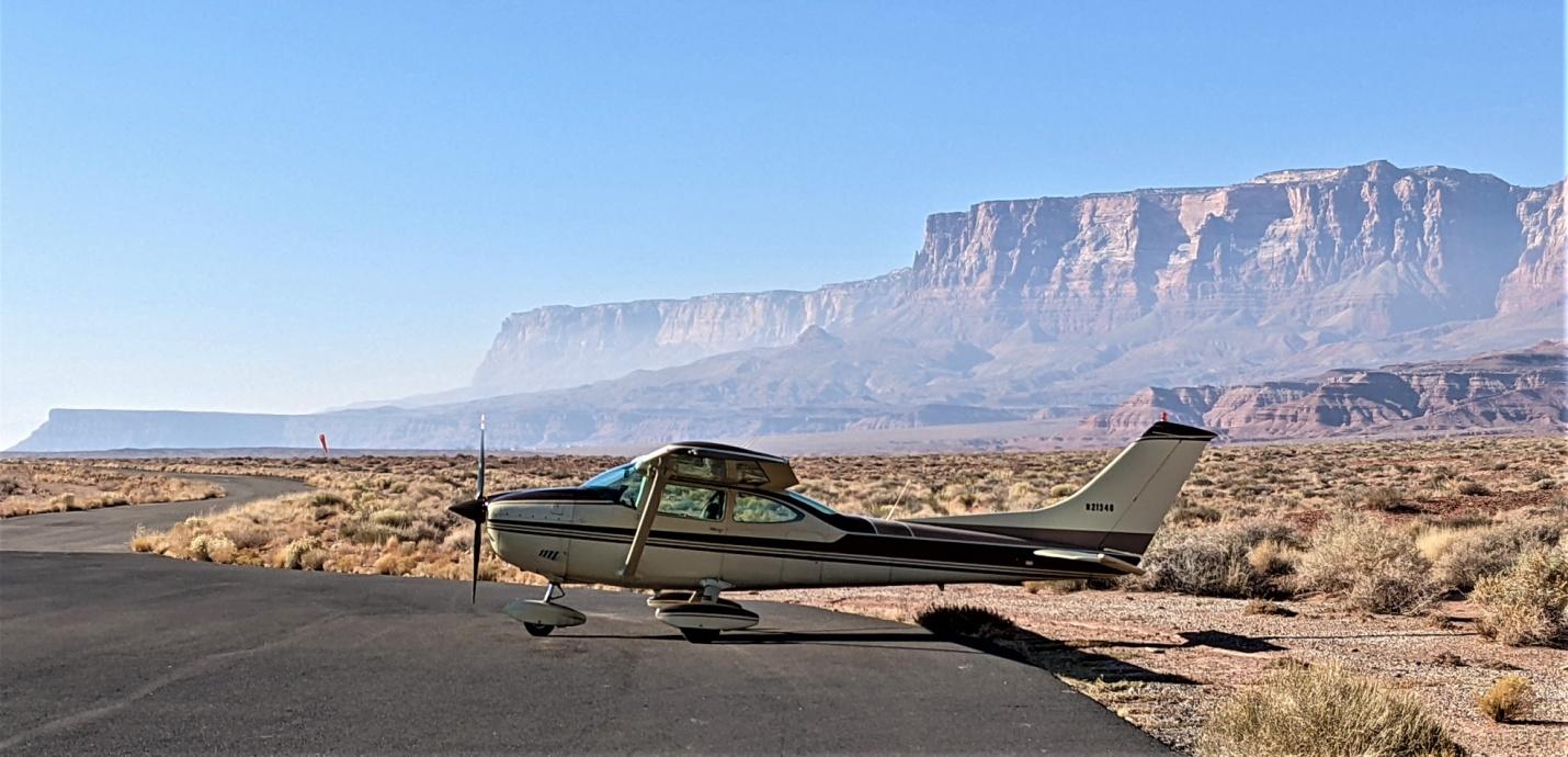
The airstrip is narrow and gave us a good spine massage on landing. The “ramp” is a wider paved area at the north end, near a motel, restaurant and tourist shop run by local Navajo. Here’s our worthy steed after shutdown.
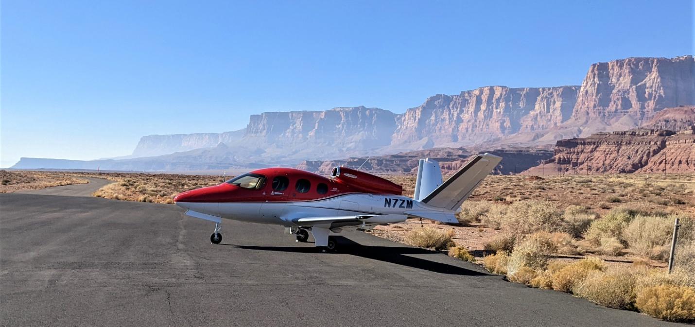
The owner had just bought this very pretty Cirrus SR50 & finished his type training a few weeks earlier. His most memorable comment: “the runway was bumpier than I expected.”
We got back airborne, circled once to gain required altitude then took off to the south, returning to Flagstaff through Zuni corridor at 10.5K. Even in the off season there was a steady stream of helicopter tours whizzing along far below.
Back at the field we buttoned up the plane again and headed off to check out the Museum of Northern Arizona, which has some nicely put together displays of cultural artifacts and informational panels about the past and present of the natives of the Four Corners area (Navajo, Hopi, Ute and Zuni). Worth a visit if you’re in the neighborhood.
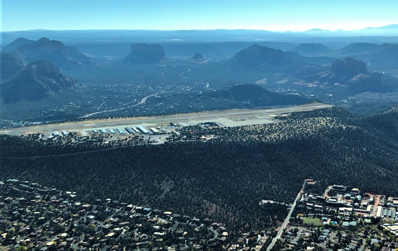
Finally, on Sunday we planned to make a later start, waiting until the frost melted and hopefully we wouldn’t need to have the FBO pull out its expensive hot-air-blower to get the plane started. Arriving at the field around 9am, the frost was indeed already mostly gone, and the engine caught on the second try. Cleared by the tower for a downwind departure from runway 3, we set off for the short downhill flight to Sedona. (Ground: “say direction of departure”; Me: “southbound”; Ground: “roger”. Me after runup: “Tower, N21348 ready to go, requesting downwind departure.” Tower, same guy: “Runway 3, cleared for takeoff”. Me: “Do you want me on a left or right downwind?” Tower: “That’s entirely up to you”.)
Sedona is just 18 nm to the south, so it was a very short hop. KFLG is at 7000’, while Sedona is at just 4800’, so I only climbed to about 1500’ AGL, leveling off briefly before the descent. Sedona is in kind of a wide blind canyon, with high mesas and cliffs on three sides. Here’s the view off one wing on the approach.
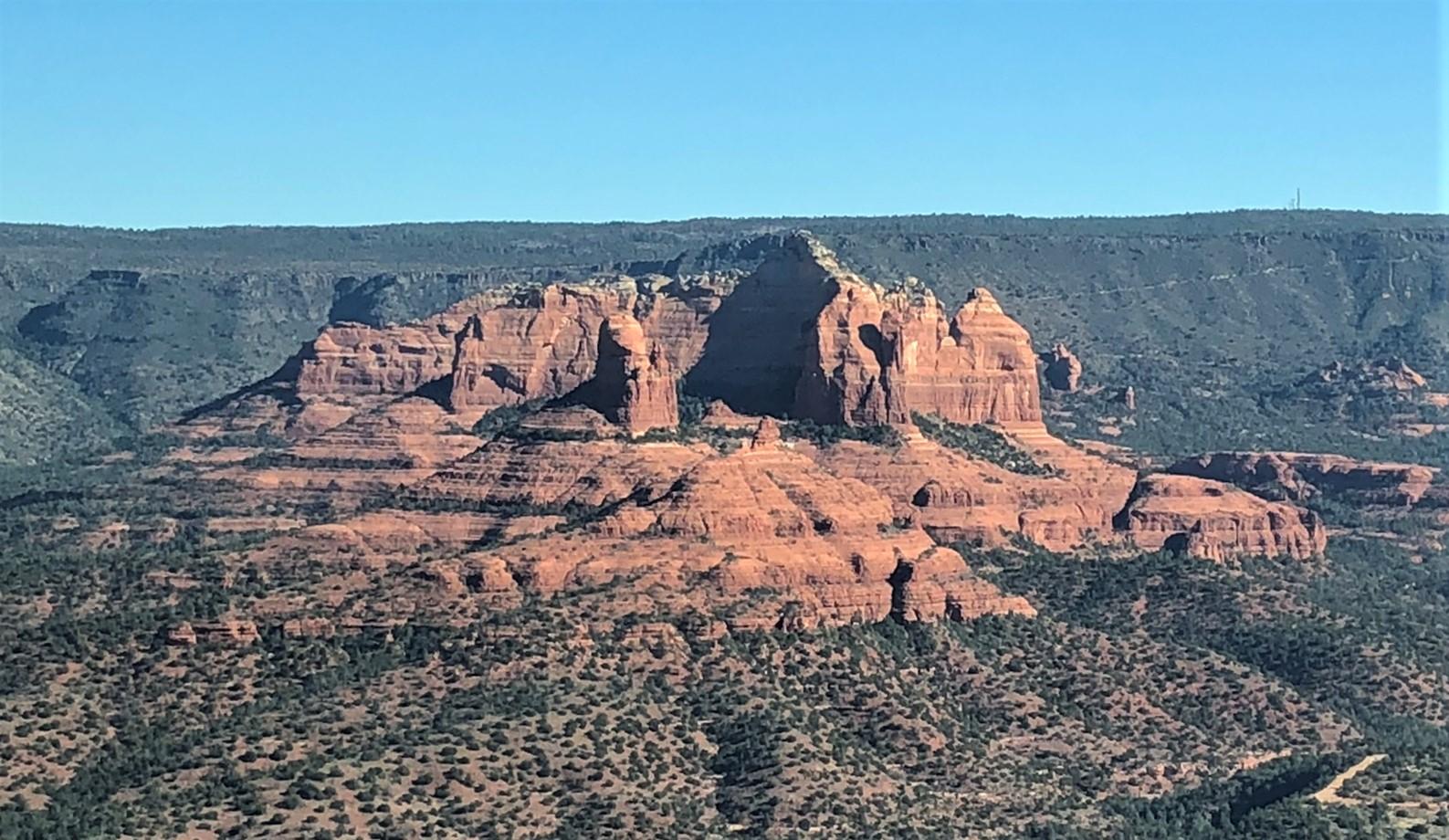
The airport is itself on a mesa several hundred feet above town, with the runway ending in cliffs at either end. The Foreflight airport information page shows pattern altitude as being 7000’ (2100 AGL) which I thought was really weird, but what do I know? Turns out that’s only for jets. Had I looked more carefully I would have noticed the little right arrow next to the 7000’ giving a popup showing “Light Aircraft: 6000 MSL”. Anyway, it wasn’t a busy day and my unconventional descent through the pattern (more or less continuous from cruise) worked out ok. This strip is known for its unusual visuals and its downdrafts on short final, but the winds were benign and I made my only greaser landing of the whole trip. We had breakfast at the Mesa Grill, just off the ramp.
Here’s a view of the airstrip as we left. The red rock formations of the area are spectacular & our piddly phone camera photos can’t do them justice.
The return flight was much less inspiring than the outbound one. Winds over the Sierras had picked up and were over 30kts at 14K. I had in any case planned for the southern route, figuring that like when we came back from Joshua Tree in the spring, the Edwards AFB restricted area would be open on a Sunday cutting off a good chunk of detour to the south or the complexity of navigating the Trona Gap. Crossing the California border, I asked the Center controller whether I’d be able to transition R-2515. He came back quickly in the negative saying it was “hot” all the time. Something about his reply made me suspect that he hadn’t actually checked. But I turned slightly to pass to the south of the area. A short while later, I had a different controller and asked her the same question. She immediately replied “that will be no problem”. So I turned back to a more northerly heading and a bit later with Joshua Control got “cleared through R-2515, maintain at or above 7000’.” Just high enough so you’d need a really good camera to get a good photo of the super-secret planes they’re testing there to try to break the sound barrier. On the far side of the restricted area we stopped at California City Muni (L71) just at the foot of the Tehachapis, filled up on cheap gas for the last leg and had a bio break.
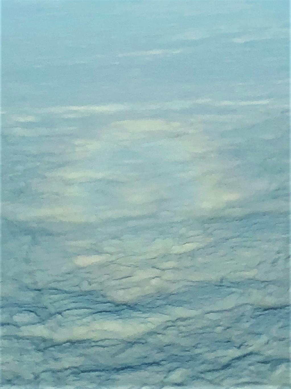
Leaving L71 we paralleled the mountains there ‘til we were able to climb enough to get over the ridgeline, which rises steeply over 5000’ from the airport elevation. We crossed the mountains at 8.5K pointed towards home. Crossing into the central valley, we looked down at solid white, broken only by the Sierras rising up to the east and a faint smudge of coastal mountains far to the west. The overcast (tops around 2000’) remained until we were nearly home. METARs showed IFR to LIFR all the way up. (There was a fatal crash of a Bonanza leaving KVIS IFR a few hours later.) Not much to see, though we did catch a “glory” off the right wing at one point. Stiff winds cost us about 20kts of ground speed.
Getting back with Norcal and close to home, we started getting bossed around again. (“Skylane 348, begin your VFR descent. Remain at or below 4,500.”) Back on the ground at KCCR, total Hobbs time for the entire trip: just over 13 hours. It was a lot of hands-on flying in a few days and pretty tiring. But Northern Arizona is spectacularly beautiful, Flagstaff was charming and had decent food and lively street life, and the trip over the Sierras was one I’ve wanted to do since getting my PPL. Highly recommended.
* Most photos were shot by Catherine on her iphone. A few by me on my non-iphone.
No comments:
Post a Comment