Thursday, January 25, 2024

Over the Sierras to Mammoth Lake

 [September 2023]


We made this trip to June Lake in NRI's fixed gear 182, newly upgraded with a Garmin AP, which makes travel so much more relaxing. I've only ventured over the Sierras when the winds are light. One of my instructors - I can't remember which - suggested 20kt as an upper limit for winds aloft across the summit. Any more than that and the turbulence and potentially downdrafts start to get unpleasant. 


On this trip we went over Yosemite valley with El Cap off the left wing, then up past Half Dome to Tuolumne meadows and the Tioga pass. Those wiggles in the route going over the summit are mostly about avoiding the higher terrain. Having done this trip now three times I think I could do it without GPS guidance, but I still preferred to program the GTN with all the waypoints, which I figured out in Foreflight using Waypoint/Radial/Distance off of FRA and KMMH. In total there are 7 waypoints going over the top., for which I had us up at 12.5K for terrain clearance of at least 2K. Once you get to the Tioga pass itself you're going from terrain with 13K peaks around you to looking out at Mono Lake far below at 6K.

Mammoth Lakes has a single runway, no tower and a hospitable little FBO. We gathered all our stuff, got a ride from the line guy to the car rental counter, where we ran into a problem of my making, trying to save on the car rental by rebooking at the last minute, only to find when we got there that reservations with less than 48 hours lead time are not guaranteed.

After getting the car situation straightened out we headed over to the town of June Lake where we stayed in a comfortable motel-ish lodge. After settling in, the next order of business was heading over to Wild Willy's Hot Spring, just southeast of the airstrip. It's an open site about a 1/4 mile down a boardwalk from a parking area at the end of a gravel road. There were lots of people there, but the semi-natural pool we chose for our soak wasn't too crowded. Surreptitious parting photo below. 

The others there were mostly young people who'd just finished a marathon-length trail race in the mountains. They were mainly Europeans plus one American, coincidentally from Jackson Hole and who knew people who knew Anna. The Europeans were from Italy, Romania, France, Norway, Finland and I can't remember where else. The Mammoth run was the last of an annual series of races, the first two of which were in the Alps, the third in Colorado. Next year they said the group that puts these on will be adding two more in Asia somewhere - probably one in Japan and one somewhere else.


Next day we went for a somewhat strenuous hike up to Gem lake, about 6 miles total out & back. Then another visit to Wild Willy's, followed by dinner in Mammoth at a very good Cuban-Puerto Rican place called Dos Alas. 

Day 3 was the return flight. I wanted to get up to 12.5K again for the mountain crossing, but at about 10K, as we buzzed along near the mountains we'd hiked the day before, I found that I couldn't get the plane to climb. Our track shows the groundspeed dropping to ~90kts with no climb. I had the plane very nose high as the speed bled off, before I finally realized that we were just caught in a fairly strong downdraft from the ~20kt winds over the summit. Turning away from the mountains for a bit fixed the problem. The rest of the return flight was pretty routine - at any rate I no longer remember anything about it.


Wednesday, November 22, 2023

Trip to Grand Canyon & Sedona

[December 2021]

Route: KCCR - KBIH - KFLG - L41 - KFLG - KSEZ - L71 - KCCR


With Catherine, who supported my taking up flying and is now paying the price, we loaded up N21348 and set off for Flagstaff, AZ, for a long weekend visit to the Grand Canyon and vicinity. This was by far my longest trip yet and tested the limits of my endurance and our bladders. Our plan was to fly to Flagstaff on Thursday, drive to the Grand Canyon on Friday for a day hike, fly over the GC to Marble Canyon airstrip on Saturday, then head home with a stop for brunch in Sedona on Sunday. Lots of spectacular scenery, a few days in the hip outdoorsy college town of Flagstaff and a lot of flying time. We had perfect weather, and I didn’t mind that there was no opportunity to use my shiny new instrument rating.

I had originally planned the outbound leg around the south end of the Sierras through the Trona Gap (a 4 mile wide corridor between two restricted airspaces), in order to avoid too much high altitude mountain flying and the associated turbulence, rollers and need for O2. (There was no way to avoid a lot of mountainous terrain on this trip, but none of it requires altitudes over 11.5K if you don’t go over the Sierras.) However, as the trip got closer and I started watching the weather forecasts, it looked like the winds would be extremely benign over the summit, and I switched to the shorter and much more scenic route over Yosemite and the Tioga Pass. I arranged with Mike C. to get the club’s oxygen bottle (which apparently hasn’t seen use for a long time and whose accompanying plastic tubing has decayed to near unusability), got it filled at PSA and figured out how to jerry rig a connection to my cannula. (I had one for my wife but she chose not to use it.) I’ve hiked at over 14K in the last decade so I wasn’t too worried about my ability to function, but also didn’t want to take needless risks. The first stage of my planned route was over Hetch Hetchy (and the Grand Canyon of the Tuolumne, so making this trip a Grand Canyon twofer), Tuolumne Meadows, navigating the Tioga Pass at 12.5K, then descending to Bishop for refueling and a picnic lunch.

The departure day was forecast clear but with tule fog sticking around until fairly late. In the event the field was VFR by 9am. With delays for picking up the oxygen and figuring out how to hook it up, we took off around 10:30 and climbed to 11.5K eastbound across the central valley. I started watching my oxygen level and as it hit the low 80s I turned on the supply, which quickly took me up to 99. (I can’t say I felt any different.) The route was pretty direct until reaching Tuolumne Meadows. Approaching the high country we climbed another 1000’ which gave plenty of clearance, though there are nearby ridges and peaks at over 13K. Going over Tuolumne Meadows we watched a faster plane zoom past 1000’ below, dodging and weaving to avoid terrain. We lost sight of him and he might have gone through Buckeye Pass to the north. The first photo below shows the view towards Half Dome and Mt. Starr King from over Tuolumne Meadows. Somewhere around here Oakland Center lost us on radar & cut us loose.

half dome.JPEG

After Tuolumne Meadows, we made a couple of sharp turns to get through the Tioga Pass. (I had programmed those into the GTN with VOR/radial/distance user waypoints.) The photo below shows the east side of the Tioga Pass from the passenger seat, with Mono Lake in the distance. You can just make out the road on the north side of the canyon. Just after this spot we turned right to drop down that canyon. 

The flight down the east side of the mountains, past Mammoth Lakes to Bishop was uneventful. There was a light breeze from the north, so I took us around to land on 30. We sat by the FBO and ate our picnic lunch. (There’s a Thai restaurant on the field but it was closed.) I then had my first go at self-fueling, and after a couple of miscues got the plane topped up for the next, longer leg.


tioga pass.jpg


The next segment took us south of the restricted areas, over the northern end of Death Valley, and eastward towards Vegas. We took off from Bishop paralleling the mountains on the east flank of the Owens Valley, gaining enough altitude to turn southeast, then crossing the MOAs. The desert looked pretty harsh & forbidding, but at least there was no shortage of flat-looking areas for emergency outs. 

I had trouble getting flight following in the area. I was able to reach Joshua Control, but they said they had no radar coverage at my altitude (9.5K). Eventually I got in touch with LA Center about 50nm west of LAS. Soon after, approach asked my intentions and gave me a Bravo transition unasked. We flew directly over KLAS and headed for the Hoover Dam. Unfortunately that took us right into the arrivals, and approach turned us to the south and kept us high, so we weren’t able to get a closeup look at the dam, though it still looked pretty impressive from altitude. We continued northeast along the edge of Lake Mead, then turned southeast to cross the western end of the Grand Canyon. The sun was already low so we got spectacular colors on the canyon walls. You can just make out the Colorado at the bottom of the inner canyon here.


grand canyon.jpeg

The sun went down before we made KFLG, and I had a little reminder of the difficulty of finding an unfamiliar field in the dark. Between the airport’s beacon and the moving map with the pink line for visual approach, though, it wasn’t a real problem. KFLG is a class D field and as far as I could tell it was the same controller on the radio for both tower and ground on all four interactions we had. He was, uh, not a micromanager. (He didn’t want me to bother him on the ground frequency once I got off the runway, and three days later he didn’t really care how I left the area.) 

We parked at the FBO (Wiseman Aviation) where the fuel is expensive but the linemen are helpful and friendly. The kid on duty helped us with our luggage, then took us on his cart on the roundabout route over to the main terminal where we’d arranged a car rental. 

The next day was on the ground: we drove up to the Canyon & hiked down the South Kaibab trail, a bit less than half way to the river (about 2200’ vertical). That got us just below ONeill’s butte, the fin sticking up on the lower part of the ridge in the picture below. It’s a spectacular hike, easily doable in a few hours down & back on a mild day. Just to give an idea, the first marked stop on the trail is called “Ooh Aah Point”. I think the experience of seeing the Canyon can be summarized by saying that it’s mind boggling even if you expect your mind to be boggled.

PXL_20211203_232826684.jpg

After the hike back up, we strolled along the rim until sunset watching the light and colors change, then got on the road for the 90 minute drive back to Flagstaff. Just before we got to the town, Catherine had been looking out at the now pitch dark sky and exclaimed first “that’s weird” then “whoa, what’s that?” then “stop the car”. I pulled over, got out & looked up to see a line of SpaceX Starlink satellites crossing the sky. They looked something like this: https://www.youtube.com/watch?v=MzAVq9amZSI&t=0s. It was very surreal - impossible to tell how high or how fast they were moving, but they were pretty unmistakable and very bright. No wonder the professional astronomers working with the billion dollar telescopes & looking at faint ancient light are upset…

Day 3 we got an early start – up at 6:30, quick breakfast, then off to the airport. I wanted to fly up to Marble Canyon (L41), a paved strip down below the rim of the Canyon, and Catherine wanted time later in the day to visit some terrestrial attractions in town. We got to the airport by 8ish, only to find the plane covered in frost. Having just finished my instrument training, I was duly concerned about the effects of even a bit of frost on the wings & control surfaces, so we spent a half hour with paper towels and ladder cleaning off the wings & tail. About the time the sun was finally warming the surfaces above freezing, we got in & tried to get going. No dice. The engine wouldn’t start. After about 10 tries where the engine would turn over a few times & seem to catch before quitting, we finally got help from a lineman who brought over a preheater, which worked sort of like a little jet engine blowing hot diesel exhaust at the air intakes. After fifteen minutes it started right up. So, an hour or so later than planned, we headed off to cross the Canyon & then land in it. 

The GC has its own FARs, mainly for commercial tour operators, but also for GA, on where you can fly and at what altitude. The sectional shows north/south “corridors” where you can cross, with self-announce on entry & exit. We took the Dragon corridor north at 11.5K, then dropping to 9.5K as we continued up the Marble Canyon Sector. L41 is up at the northern end of the National Park area at 3600’ elevation, well below the Canyon rim at around 7K. The flight rules in the area allow planes to descend below 3K AGL “within 3 miles of the airport”. That’s not a lot of room for a normal descent. Instead, I got more or less over the field then did a wide spiraling descent. Here’s the track log. That jog at the start was to try to catch a good view of the famous Horseshoe Bend oxbow just to the north. Turns out I was off by one oxbow & the one I was looking for is further to the north. 


This was the view from the right window as we descended below the rim. 

IMG_2090.jpeg

The airstrip is narrow and gave us a good spine massage on landing. The “ramp” is a wider paved area at the north end, near a motel, restaurant and tourist shop run by local Navajo. Here’s our worthy steed after shutdown.

PXL_20211204_181506755.jpg

We crossed the road to the restaurant and had lunch. While we were there another plane landed & this was what we saw when we left.

PXL_20211204_191235091.MP.jpg

The owner had just bought this very pretty Cirrus SR50 & finished his type training a few weeks earlier. His most memorable comment: “the runway was bumpier than I expected.” 

We got back airborne, circled once to gain required altitude then took off to the south, returning to Flagstaff through Zuni corridor at 10.5K. Even in the off season there was a steady stream of helicopter tours whizzing along far below.

Back at the field we buttoned up the plane again and headed off to check out the Museum of Northern Arizona, which has some nicely put together displays of cultural artifacts and informational panels about the past and present of the natives of the Four Corners area (Navajo, Hopi, Ute and Zuni). Worth a visit if you’re in the neighborhood.

Finally, on Sunday we planned to make a later start, waiting until the frost melted and hopefully we wouldn’t need to have the FBO pull out its expensive hot-air-blower to get the plane started. Arriving at the field around 9am, the frost was indeed already mostly gone, and the engine caught on the second try. Cleared by the tower for a downwind departure from runway 3, we set off for the short downhill flight to Sedona. (Ground: “say direction of departure”; Me: “southbound”; Ground: “roger”. Me after runup: “Tower, N21348 ready to go, requesting downwind departure.” Tower, same guy: “Runway 3, cleared for takeoff”. Me: “Do you want me on a left or right downwind?” Tower: “That’s entirely up to you”.) 

Sedona is just 18 nm to the south, so it was a very short hop. KFLG is at 7000’, while Sedona is at just 4800’, so I only climbed to about 1500’ AGL, leveling off briefly before the descent. Sedona is in kind of a wide blind canyon, with high mesas and cliffs on three sides. Here’s the view off one wing on the approach. 

IMG_2109.jpeg

The airport is itself on a mesa several hundred feet above town, with the runway ending in cliffs at either end. The Foreflight airport information page shows pattern altitude as being 7000’ (2100 AGL) which I thought was really weird, but what do I know? Turns out that’s only for jets. Had I looked more carefully I would have noticed the little right arrow next to the 7000’ giving a popup showing “Light Aircraft: 6000 MSL”. Anyway, it wasn’t a busy day and my unconventional descent through the pattern (more or less continuous from cruise) worked out ok. This strip is known for its unusual visuals and its downdrafts on short final, but the winds were benign and I made my only greaser landing of the whole trip. We had breakfast at the Mesa Grill, just off the ramp. 

Here’s a view of the airstrip as we left. The red rock formations of the area are spectacular & our piddly phone camera photos can’t do them justice. 

IMG_2110.jpeg


The return flight was much less inspiring than the outbound one. Winds over the Sierras had picked up and were over 30kts at 14K. I had in any case planned for the southern route, figuring that like when we came back from Joshua Tree in the spring, the Edwards AFB restricted area would be open on a Sunday cutting off a good chunk of detour to the south or the complexity of navigating the Trona Gap. Crossing the California border, I asked the Center controller whether I’d be able to transition R-2515. He came back quickly in the negative saying it was “hot” all the time. Something about his reply made me suspect that he hadn’t actually checked. But I turned slightly to pass to the south of the area. A short while later, I had a different controller and asked her the same question. She immediately replied “that will be no problem”. So I turned back to a  more northerly heading and a bit later with Joshua Control got “cleared through R-2515, maintain at or above 7000’.” Just high enough so you’d need a really good camera to get a good photo of the super-secret planes they’re testing there to try to break the sound barrier. On the far side of the restricted area we stopped at California City Muni (L71) just at the foot of the Tehachapis, filled up on cheap gas for the last leg and had a bio break.

Leaving L71 we paralleled the mountains there ‘til we were able to climb enough to get over the ridgeline, which rises steeply over 5000’ from the airport elevation. We crossed the mountains at 8.5K pointed towards home. Crossing into the central valley, we looked down at solid white, broken only by the Sierras rising up to the east and a faint smudge of coastal mountains far to the west. The overcast (tops around 2000’) remained until we were nearly home. METARs showed IFR to LIFR all the way up. (There was a fatal crash of a Bonanza leaving KVIS IFR a few hours later.) Not much to see, though we did catch a “glory” off the right wing at one point. Stiff winds cost us about 20kts of ground speed.

IMG_2117.jpeg

Getting back with Norcal and close to home, we started getting bossed around again. (“Skylane 348, begin your VFR descent. Remain at or below 4,500.”) Back on the ground at KCCR, total Hobbs time for the entire trip: just over 13 hours. It was a lot of hands-on flying in a few days and pretty tiring. But Northern Arizona is spectacularly beautiful, Flagstaff was charming and had decent food and lively street life, and the trip over the Sierras was one I’ve wanted to do since getting my PPL. Highly recommended.

* Most photos were shot by Catherine on her iphone. A few by me on my non-iphone.

Trip to Washington state, the Olympic Peninsula and the San Juans


[Trip dates August 26-28, 2022.]

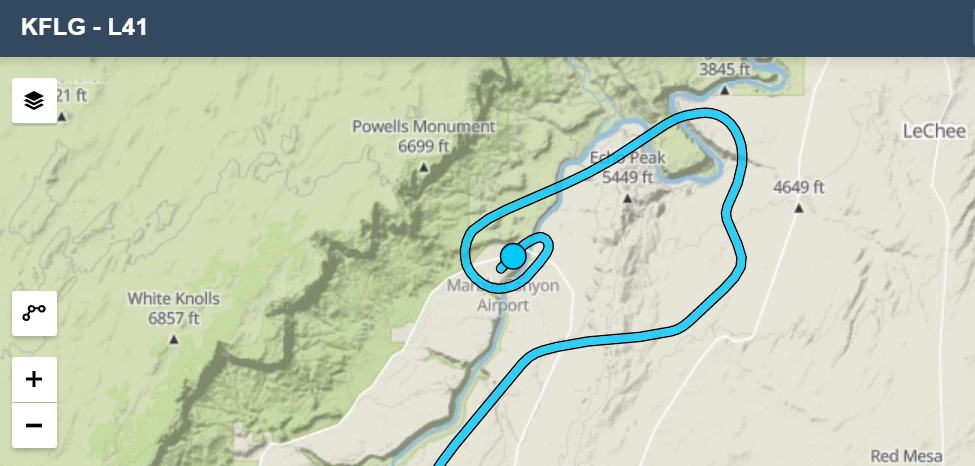
Full route itinerary: KCCR - KLMT - 0S9 - KORS - 0S9 - KOLM - KRBG - KCCR. 13+ hrs on the Hobbs.

With Catherine back East for a week, I decided to embark on a longish trip to the Northwest corner of the lower 48 – an area I’ve long wanted to visit, but with weather that I wouldn’t have ventured before getting my instrument rating last fall. Joined by poker pal JT, I set off for Port Townsend and Olympia, Washington, to visit mutual friends, Bay Area transplants we’ve kept up with over the years. The full track over the 3 days is to the left, over a VFR sectional. 

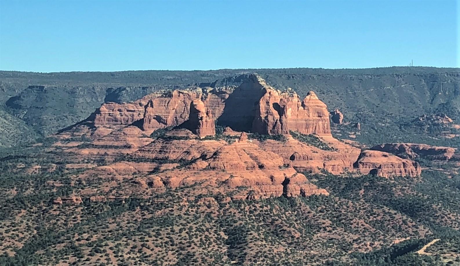
We left around 9:30 on Friday morning in N21348, a C182, enjoying the recently installed G5 and the luxury of not having to reset the DG every 15 minutes. We headed slightly NW from CCR on a route taking us past Mt Shasta, and on to Klamath Falls/Crater Lake for refueling, bathroom break and lunch. If you look closely, you can see some wiggles in the flight track around Redding, where I was giving JT slow flight and stall lessons. 

Klamath is a class D with a lot of military training, though none was happening while we were there.

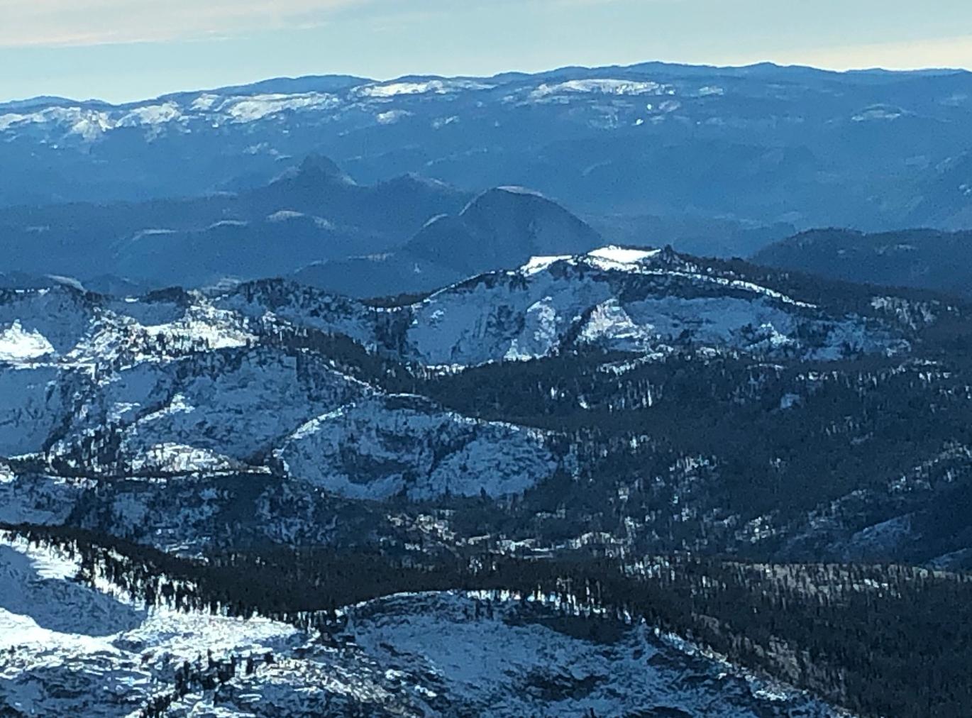
Leaving KLMT we turned back to the NW, passing Crater Lake and skirting the edge of a fire-fighting TFR. We were initially at 10.5K, but popped up to just under 12.5 for a little while to get above a layer of cumulus and mountain turbulence. I had my pulse oximeter going & could see quite a drop going from 10.5 to 12.5, so we didn’t stay there very long. After passing south of the TFR, we turned more northerly, passing Eugene, Corvallis and Portland on the left and getting great views of the Cascade volcanoes to the right. 

I had been watching the weather intently during the previous week, hoping to get a clear day for a low altitude flyby over Seattle on the way north to Port Townsend. Trying to figure out how to make sightseeing around the SEA class B work, I benefitted from Cunningham’s law: “the best way to get the right answer on the internet is not to ask a question; it's to post the wrong answer”. I posted a proposed route on reddit and asked for feedback, which came quickly: my idea was stupid, it would never work, and here’s what I should do instead. I also discovered that the Boeing Field controllers have a “contact a controller” link on their facebook page & asked for & quickly got details about transitioning through the BFI airspace. 


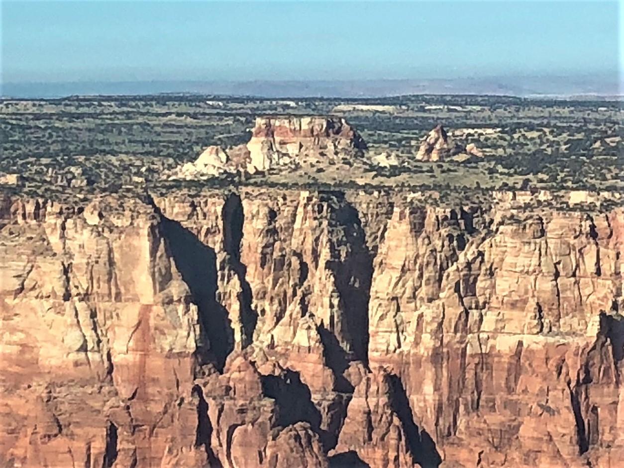
Mt St Helens, I think (might be Mt Adams)

In the event, on Friday morning the weather in the Seattle area was forecast to be not great, with several cloud layers and low stratus starting around Portland. I filed an IFR plan before we left, starting from a waypoint abeam Mt. St. Helens up to 0S9 (Jefferson County International), planning to activate it only if we had to. When we got close to Portland it was evident that it would be necessary – the area had solid undercast and we could see lots of puffy clouds ahead, so I picked up the clearance from Seattle Center. They routed us up the west side of Puget Sound where I got some rare time in actual IMC. It was mostly quick hits, in & out of cumulus and only a little bumpy. Not too many sights to see on the last leg, at least for me, though JT was enjoying looking at the islands passing down below when we could see them.

Seattle kept us at 8K before handing us off to Whidbey Approach just a few miles short of the field, denying my request for lower. JeffCo has only one approach, the RNAV-A, which is aligned with runway 9 and has a normal descent angle (though it’s labeled “N/A” for some reason), so I assume it’s circling-only because it doesn’t have the right runway markings. (I’m asking for another round of Cunningham’s law here I think.) The controller gave me “direct JAWBN, direct YAYUB, cross JAWBN yadda yadda cleared approach” when we were just a few miles out, leaving me scrambling because JAWBN is not a waypoint on the procedure, though it is shown on the approach plate as a feeder fix off an airway, which we were not on. With some minor missteps, we got aligned with the transition & headed down to the procedure turn at the IAF in plenty of time. (Our friend CK, out at the airport to meet us & watching our flight path on flightradar24 was a bit mystified and thought we were mistakenly heading for Port Angeles, an hour’s drive down the road.) We broke out around 2000 feet, well above the FAF, so despite all the IMC I don’t get to log the approach for currency.

After our Port Townsend friend CK was finished critiquing my landing (“If you’d landed in the touchdown zone you could have made the first taxiway!”) he took us to a very pleasant pub in the old “lower” town by the harbor, where I made quick work of the pint I felt I’d earned. According to CK, the town was the original harbor for the Seattle area but quickly lost out to Seattle/Tacoma when the railway ended there instead of coming all the way out the Olympic peninsula. It has a waterfront area about which you read the same kinds of stories as from SF’s Barbary Coast days (e.g., drunks waking up on a boat to Shanghai) and a “respectable” churchy uptown on the bluffs with some nice old mansions of the local gentry, which now include CK and his wife KK.

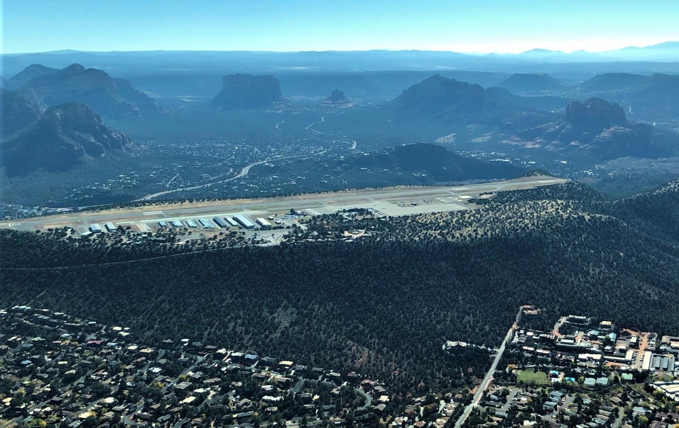
The Salish Sea (the name of the whole watery region) has maybe more microclimates than the Bay Area. Saturday dawned with low overcast in Port Townsend, and a very variable forecast for the rest of the day, but mostly clear up towards the San Juan Islands. The three of us (me, JT, CK) decided to try our luck flying up to Orcas Island for lunch. We found the airport lot nearly full – there’s a little restaurant on the field (the Spruce Goose) that’s supposed to have the best pie in the area.

Somewhere in the San Juans

I got a clearance from Whidbey Approach to get us going up through the low stratus (a few hundred feet thick with a base around 1K), found more puffy cumulus above, and quickly got into clear air as we headed north. Even though Orcas is in the US, the airspace is controlled by Victoria Terminal (which should be the name of a character in a William Gibson novel). After the handoff from Whidbey, we quickly cancelled and dropped in to the strip at the north end of the island. So I can now say I’ve talked to a Canadian controller (who politely didn’t correct my calling her “Victoria Approach”).

A short 20 minute walk got us to Eastsound, a harbor town on the south side of the north end of the island (shaped like a ש  with the bottom to the north). After lunch, checking out the farmers’ market and snacking on all the ripe blackberries growing along the path, we got airborne again & had a 30 minute tour of the San Juans before heading back to JeffCo. The direct route across San Juan or Lopez Island to the Olympic Peninsula crosses about 20 miles of open water, so I took a land-hugging route along Whidbey Island through the Naval Air Station’s class C. On Friday I’d heard other GA pilots being told to stay out of the Charlie, but I guess there’s less happening on the weekend, and I got no peep when I headed for the shoreline. The islands are amazingly beautiful. CK does a lot of sailing in the area and was really enjoying the 182’s-eye view from above. He showed his appreciation by offering praise for my landing back at 0S9: “Nice. But aren’t you supposed to land straight?”

Sunday dawned mostly clear in Port Townsend, but the east side of Puget Sound down to Olympia had a broken layer, nixing the idea of a Seattle flyby on the way south. CK dropped us back at the field and I filed another IFR plan, this time picking it up in the air. By the time we got close to Olympia, where our other friends live, it was CAVU, but I flew the approach anyway. The jagged Olympic range was a spectacular contrast with the network of islands, inlets and waterways on our route. 

After second breakfast with our Olympia friends BW and RW we launched for the last long legs home. We made one stop in Roseburg for bathroom break & refueling then quickly got going again. Best gas prices on the trip, in case anyone’s headed up that way. South of RBG we passed a TFR and a towering column of smoke from a fire in southern Oregon near the California border. The next 50-odd miles were pretty murky. Our route took us over terrain up to almost 8K and it started getting bumpy at 9.5k. Climbing another 2000 feet smoothed things out for the rest of the ride and got us above a lot of the smoke. Somewhere in there over rugged terrain we picked up an ELT signal on 121.5, which I relayed to the controller.

We soon passed the Trinity Alps off to the west and could see Shasta again off to the right. Another 90 minutes had us back in Concord. Total distance ~1400 nm. 13+ on the Hobbs. Not a cheap outing, and a lot of time in the seat, but lots of fun.

Thanks to JT for the photos.


From now on this is going to be a Flying Blog

Mostly a place to keep a record of interesting places to go, good routes and Stuff that Happened.

First post - my new favorite route from Concord to Half Moon Bay. I found this via a youtube video but haven't seen it described anywhere in detail. Yet based on controller familiarity it seems to be well known. From Concord, the route goes through the Oakland Charlie directly over the field, then the San Mateo bridge midspan, through the SQL Delta and then a climb over the peninsula ridge before descending to HAF. It's pretty much the shortest route outside the SFO Bravo. If you're programming it into your navigator, it's KCCR - OAK - VPMID - KSQL - KHAF.  The OAK waypoint is not exactly right - the instruction will be to cross the Coliseum then head for the 30 numbers (assuming, as is essentially always the case in nice weather, that OAK is landing to the northwest). I now have those spots set up as VOR/radial/distance waypoints in Foreflight. But you're navigating VFR, so you can adjust as needed without the programming.

Unusually, the first call leaving CCR is to OAK tower (north, the GA one), not NorCal. My habit is to climb to 3K out of CCR and listen on the OAK tower frequency as soon as I'm clear of the CCR Delta. You can only hear the pilot side until getting above 2K and within about 15 miles. Once you hear the tower, call them up. They'll descend you to 2K approaching the field. Nearing the coliseum they'll switch you to the south tower which will send you over the 30 #'s, descend you to 1.4K & send you to the midspan. Before reaching the bridge, they'll ship you to SQL for that transition. SQL's D goes right up to the B shelf. My personal custom is to ask for the transition. It's never been denied. I suppose worst case if they refuse entry you could turn south and go through the gap between SQL and PAO airspace.

The B shelf is at 1.5K along that stretch. Very likely you'll cross under SFO arrivals, often two landing in parallel on 28L & R. If they're not too busy, SQL may offer to switch you to NorCal, but by the time you cross over there you're nearly at HAF so I no longer bother. Leaving that B shelf, you can now climb to 2.5 or 3K to cross the ridgeline. 

Lots of altitude changes but very scenic. Here is a recent track log.


Thursday, July 30, 2015

I'm Not Worried About the Drought

With an El Niño year looming I'm optimistically looking forward to a great ski season. Though the drought may be over shortly, we've still been doing our small part to reduce water use, cutting our yard watering by 40% since 2013. There's a lot of brown out there now. Other Californians now have about 30 gallons per day more from our common supply. You're welcome.

Just today I read a story about the impending disappearance of the Ogallalla aquifer east of the Rockies, due to the fact that plains farmers have been pumping water out of it 10 times faster than its natural recharge rate. That's just the latest in a regular drumbeat of scary stories about how, thanks to the tragedy of the commons (where no individual farmer has any incentive to conserve, because his neighbor's pumps will drain the same water source as his), the aquifers of the West will soon be gone. The other day someone brought up the seemingly outrageous amount of water used by almonds, and the fact that California farmers in some areas are still planting new trees, even as others have to let theirs die.

Someone else asked me recently whether I was worried. I'm not. It's a commonplace observation that urban users account for only 20% of the total water used in California. And much of that goes to water peoples' yards in the hotter inland areas. The densest urban areas account for a small fraction of the state's total. So we're really not at risk of running out in the parts of the state where people want to live and where most of the economic activity happens.

What might happen (unless the farmers can get past their libertarian principles and work together) is that some farms will be abandoned and some foods will get more expensive. Probably not by much, though. (Although California is now the almond capital of the world, it didn't used to be, and I don't remember almonds being unaffordable when they were part of my regular snack supply as an impoverished grad student in the early '80s.) But even if some items get much more expensive, for most of us and for most of these items, their cost is just not that big a part of our budget. (I know there are lots of food-insecure people out there. I don't think they're mainly buying almonds and local beef. There are many places in the world that can produce caloric staples cheaply, and we can import all that stuff. I'm pretty sure I read a year or two ago that much of our cheap ground beef already comes from South America.) If parts of the plains turn to desert and the western side of the Central Valley has to be abandoned for farming, so be it. Bummer for those independent-spirited farmers, but I don't see why urban Californians should be concerned, other than in the general sense of being sympathetic about someone else's misfortune.

People have this notion that we must "do something" about the drought. Well, in principle a long enough drought would make the urban areas uninhabitable. But we're pretty far from that scenario. In any case there's little we can or need to do about that long term right now -- we don't even know if it's coming. Urbanites can cut back on their water use, but that won't help the farmers. And if the farmers refuse to work together to make efficient use of their collective groundwater resource, they're the main ones who will suffer the consequences. Although California has new laws that will eventually limit and manage groundwater use, lobbying by agribiz produced legislation that doesn't fully take effect for another 25 years. If the primary victims of the drought don't want to work together to solve their problem, that doesn't make it my problem.

So my main worry is that the El Niño won't materialize, and it'll be another crappy ski season. Please don't hit me.

Friday, November 21, 2014

A eulogy for Tammy

In her classroom. Photo by Jennifer Kelleher, one of her students.
When Tammy was a baby, I played peek-a-boo with her and got big laughs. In memory, her laughter was already outsized.

When she was 3 she wanted to be a ballerina. I gave her my red plastic fireman's hat and told her that if she wore that she'd be even better: a ballerina clerk. She wore it for days.

Don't ask what it meant. It was just early days of brotherly torture. But she wasn't defenseless. When she was 9 or 10, I got on the phone extension while she was talking with a friend. She responded with one of the most devastating insults one could deliver in our house: she said I was just like Nixon because I bugged people on the phone.

I told her she should credit me for her great sense of humor on the grounds that she had to have one in order to survive being my little sister. But that was just more teasing. Even in the last year, as she fought the disease and suffered the effects of the treatment, she'd reward a phone call with laughs and without complaints.

Witnessing the outpouring of love and affection she's received over the last few months reminds me of a lesson of that great 20th century american philosopher, The Wizard of Oz. As he told the Tin Man: Your heart is judged not by how much you love, but by how much you are loved by others. (He also said that hearts will never be practical until they can be made unbreakable.) Tammy's small frame held a huge heart.

Rest in peace, Tammy.

Friday, December 13, 2013

Another way the World Can End

I just found this paper from 12 years ago by Dar and De Rujula. It's about another way life on earth can be (mostly) snuffed out and might also explain why there are no old advanced civilizations. It's another variant on the world ending in fire. And unlike extinction by giant asteroid, we don't have the technology to do anything about it.

Dar is at the Technion and De Rujula at CERN. Their paper looks at what happens when a gamma ray burst (GRB) goes off in our galaxy. A GRB, visible somewhere in the cosmos about 3 times every day, is thought to be either the dying blast of a high mass supernova, in which the core collapses to either a neutron star or a black hole or the merger of two neutron stars. In either case, the combination of high angular momentum, trapped magnetic field and extreme kinetic energies - comparable to the entire rest mass of the star or stars - results in a few-second long blast of energy beamed along the opposite poles of the rotating system. We see a fraction of this energy as gamma ray photons. These two beams are tightly collimated by a combination of magnetic fields and relativistic effects, with opening angles thought to be no more than a few milliradians. That's how we can see them all the way across the universe -- an appreciable fraction of the supernova's total energy goes into these tightly focused beams. When one of them happens to point in our direction, it's bright enough to outshine everything else in the sky at gamma ray energies, even from billions of light years away.

If one of these things goes off in our own galaxy, though, we could be in trouble. Anything sufficiently close - and the center of the galaxy, 25,000 light years away, is apparently, close enough -- gets blasted with radiation. For us, it's not the direct gamma rays that are the problem. Our atmosphere blocks those pretty effectively. GRBs weren't even noticed until the 1960s, when, during the cold war, the US launched satellites designed to detect nuclear bomb blasts. (Above ground tests were banned by treaty in the early '60s.) Being above the atmosphere, they could see the GRB gamma rays.

However, once the gammas (and any other cosmic ray stuff -- protons and heavier nuclei swept up in the blast) hit the upper atmosphere, their interactions with atmospheric atoms produce a copious shower of high energy particles. The result of this air shower is a flood of high energy muons. Muons are heavy enough to zip by atomic electrons without being significantly scattered or deflected, not affected by the strong interaction, making them highly penetrating, and sufficiently long-lived for most of those created in the upper atmosphere to reach the surface. In fact, several (created by ordinary cosmic rays) go through you every second as you read this. They pass easily through the lower atmosphere and hundreds of meters of water or rock, and deposit all of their energy along the way. This puts them in a really nasty "sweet spot" of particle properties to cause trouble. Protons, which are heavier, interact strongly with atomic nuclei and lose energy before reaching the ground. Electrons are so light that they get scattered before going very far. Neutrinos just zip right through everything without losing any energy. Other particles like pions (aside from being strongly interacting) are too short-lived to reach the surface.

The net effect from the muons is a ~10 second zap of high energy radiation deposited in anything on the earth's surface or in the shallower parts of the ocean. According to the paper, a GRB at the distance of the center of the galaxy would, if pointed right at us, have enough energy to sterilize the planet's surface. Thanks to associated cosmic rays, which would follow the initial gamma pulse for a few days, no part of the planet would be safe. Dar and De Rujula calculate that a person at sea level would receive hundreds of times the fatal dose of radiation. Only the hardiest, smallest or deepest ocean life forms would have a chance of survival. Also, just for extra fun, there'd be a global firestorm from the thermal pulse in the upper atmosphere, like in the asteroid strike scenario.

Because the gamma burst comes from a supernova, it should also be accompanied by a neutrino pulse, and these might precede the gammas by seconds or minutes, because they are produced early in the collapse and escape almost immediately. The neutrinos would be imperceptible except to a few large experiments like IceCube. It seems unlikely that, even if correctly interpreted, the warning would help anyone very much. The only place to ride out the initial radiation blast would be deep underground. And the surface that anyone who happened to be down in one of these mines (such as physics grad students minding an experiment) would return to would be sterilized by the blast and the firestorm. Life would survive in the deep oceans and also among smaller, hardier critters (like these) that are able to withstand and repair cellular damage.

The paper's authors calculate an expected rate for getting caught by one of these blasts at roughly once per 100 million years. The nearest star likely to undergo this kind of supernova is Eta Carinae, but apparently its spin axis isn't pointing at us, though it's expected to blow sometime in the next million years or so. There's been some speculation that one or more of the handful of mass extinctions seen in the fossil record was due to one of these events, with arguments recently made for one about 450 million years ago as a candidate. (Oddly, while there are several later papers on the same general subject, no one seems to reference this paper. I'm not sure if that means it's wrong or if this is some petty turf thing.)

Anyway, this is another interesting way for the world to end, up there with the solar system wandering into a black hole or metastable vacuum decay. Always fun to think about!

UPDATE: A new paper suggesting that GRBs make most galaxies inhospitable to complex life. http://physics.aps.org/articles/v7/124. Doesn't mention the muon shower effect though. In fact I haven't found a later paper that references the one at the top. Maybe there's something wrong with the calculations, but de Rujula is a big name, so I doubt it's egregiously wrong.