We started from the trailhead just beyond the Mineral King ranger station. From here, every direction is up. The peaks and ridges are close in and high up on every side but the one we came up, a canyon with a 23 mile long one lane road from the little resort town of Three Rivers. We set out last Thursday morning (the 12th).
 | ||||||||
| View from the Timber Gap trail, heading up from the Mineral King trailhead |
After descending the ridge, we turned east along a creek. Our first camp was 3 miles up the valley, by the creek, near Pinto Lake. In the next campsite over was a park law enforcement guy named Brad. He had hiked in from the same trailhead and was heading for the next valley to the north to help another ranger pack up her summer home in the wilderness.
 |
| View from the Black Rock Pass trail, towards Spring Lake |
The next morning we continued east up the valley, before turning north to climb the ridge in a series of switchbacks that, after 3000 vertical feet, took us through the Black Rock pass. Brad passed us along the way, stopping briefly to take in iphone photo of a flower I wanted to identify. He promised that the ranger at Little Five Lakes would know what it was, or find it in her book. As we climbed, the glacial valley we had left came into full view and eventually we could look down on three hanging lakes feeding the creek, Spring, Cyclamen, and the uppermost one, Columbine, which we would eventually reach the next day. We could have just hiked there directly around the upper end of the valley, going off-trail to make a route shorter by a day.
From the top of the pass, around 11,600', we looked down to the north into the Little Five Lakes basin, a moonscape of mud-puddle lakes and scree. The ranger's summer yurt is visible just above the lake in the woods at high magnification in the image below. On the far side, a bit to the east is a high, imposing ridge of 12-13,000' peaks, the Kaweahs.
 |
| Little Five Lakes basin |
Returning to the trail, we slowly ascended east through some rocky woods, before turning south and then descending a 30-switchback slope which took us to Big Five Lakes, where we spent our second night. Camping near us at the lake was a 20-something couple who turned out to be chemistry grad students at Cal. They became "The Chemists" in later conversation. As in, "See you on the trail, Chemists!"
As on the previous night, the weather was great and we got a few minutes of beautiful alpenglow at sunset. The nighttime temperature probably got down into the high 30s - perfect sleeping weather, if I was any good at sleeping on a 1 1/2" mat on hard ground.
 |
| Big Five Lakes at sunset |
 | |
|
This fellow was fattening himself up for the winter, and stood up to get a good look as we passed by.
 | ||||||
| Marmot |
Eventually we got most of the way to the far end of the valley, where we began a long climb up the south side, reaching Columbine lake about 900' later. Here we took our only "group" shot.
 |
| Columbine Lake, below Sawtooth peak |
Continuing around the lake, we took a wrong turn in a wide ridge of boulders, gullies and peaks, before backtracking and discovering to our chagrin that we had another 500' or so of climbing to do, before we would reach the top of Sawtooth pass at 11,700', just to the right of the peak in the photo.
On the far side of Sawtooth pass is a steep descent across a long slope of scree consisting of sand mixed with boulders of varying sizes. We forgot the instructions of the ranger who'd written our permit, to first go north along the ridge before descending the switchbacks. So many people before us had taken random routes down the slope that we also took what seemed like the "easiest", most direct way down, through the scree. This was a mistake, because the sand-covered boulders along the way were slippery and treacherous. Eventually we crossed the slope and reconnected with the "official" switchbacks.
At the bottom of this slope, we hooked left and found Little Monarch lake. Being relatively close to the trailhead, this site was crowded with other campers by the time we arrived. We found a bare patch too near the lake, and pitched our tent. As the sun set the fish started jumping like mad. We had another perfect evening, with the moon rising above the cirque.
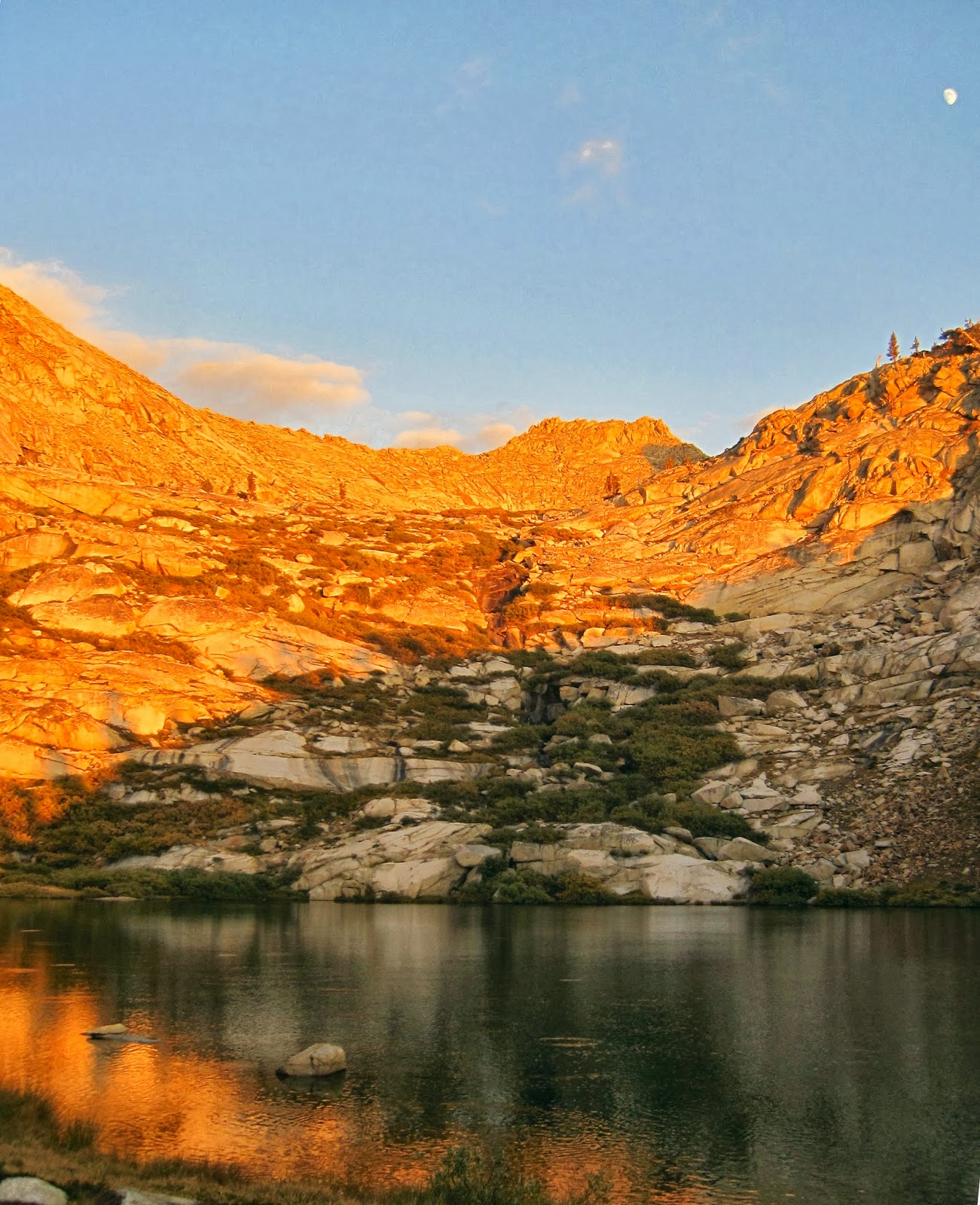 |
| Monarch Lake sunset and moonrise |
The next morning (day 4) we headed down through woods, eventually crossing a creek and reconnecting with the trail we had started on. A half mile later we were at the parking lot. Luckily, no marmots had eaten the engine hoses -- which apparently they do early in the summer, looking for salt. We headed back down the winding road and got on the highway.
Judging from the amount of water we saw, and reports from early-to-mid season hikers, we lucked out on the total absence of bugs. I never had to break out the 100% DEET I had brought. And the daytime temperature was perfect for hiking. I'm pretty sold on September trips.